Lee Navigation
The River Lea (or Lee) has its source in the Chiltern Hills and flows southeast through East London to join the River Thames at Leamouth in Blackwall. Much of the river has been canalised and this is known as the Lee Navigation (confusingly, with the alternate spelling!). The Lee Navigation is 28 miles long, running from rural Hertfordshire to the East End of London.
The River has a long history, and in the Roman period, was recorded as being a wide, fast-flowing watercourse surrounded by marshland. Old Ford (just west of the Olympic Park) was a vital crossing point and helped link London with Colchester, which for a time was the capital of Roman Britain.
The Domesday Book (1086) shows that during the Middle Ages there were at least eight water mills in the local area, producing flour for City bakers. A number of the mills were actually tidal as the tidal estuary stretched as far north as Hackney Wick.
In 1424 an Act of Parliament placed the river in the hands of the River Lee Commissioners, who were charged with improving it for navigation. It was the first act granted for improving a river in England. The Lee Navigation was important for the transport of grain from Hertfordshire to the City of London. Over the next few centuries works were regularly carried out to improve navigation, including creating towpaths, making new cuts, dredging the river and constructing locks.
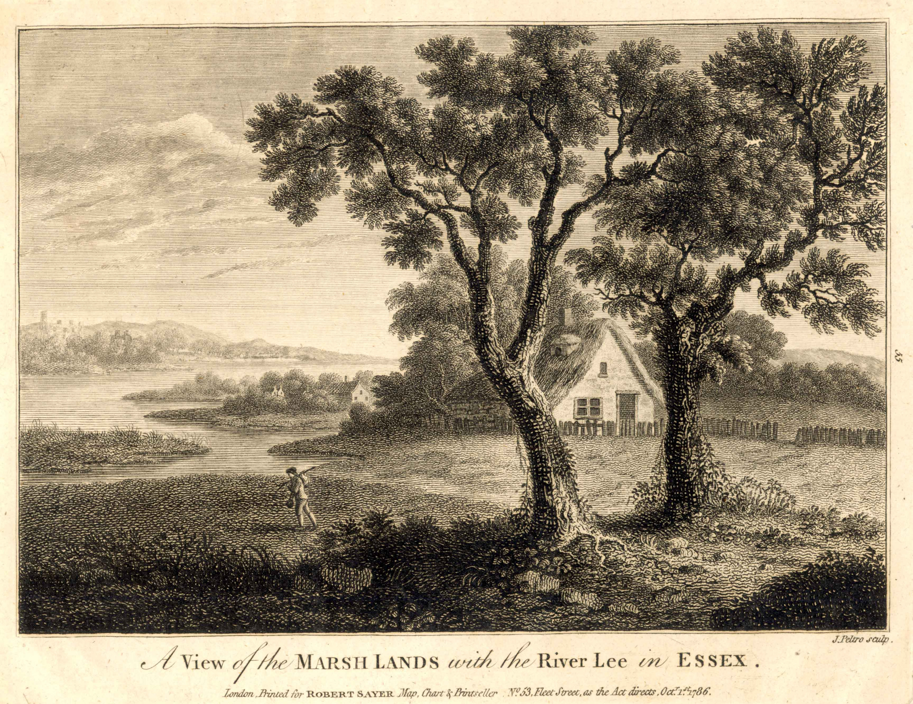
This print from 1786 shows the rural nature of the Lower Lee Valley (then a part of the county of Essex), with the river meandering through verdant marshland. It was not until the 19th century that things really began to change as the area became a hub for the manufacture of chemicals and inks, using the river water for processing and transport. Other industries also set up including the Bryant & May Match Factory, the Stratford Railway Works and Clarnico (later Trebor Sweets).
Today, now much of the local industry has gone, there are efforts to clean and re-green the Lea and its surroundings, with organisations like the Canal & River Trust and Thames 21 bringing nature back to the heart of the city.
Image credit:
A view of the Marsh Lands with the River Lee, 1786. Courtesy of Newham Archives and Local Studies Library.
Supported by